
Editing networks to test transport access
| Client | Bryan G Hall |
| Date | 05.01.2024 |

What were the objectives?
Bryan G Hall are Consulting Civil and Transportation Planning Engineers providing specialised consulting services to the construction industry to help with new build development. They have been using TRACC for several years to demonstrate multi-modal site accessibility as part of the planning process.

SWCS GIS add value to the customer by using TRACC
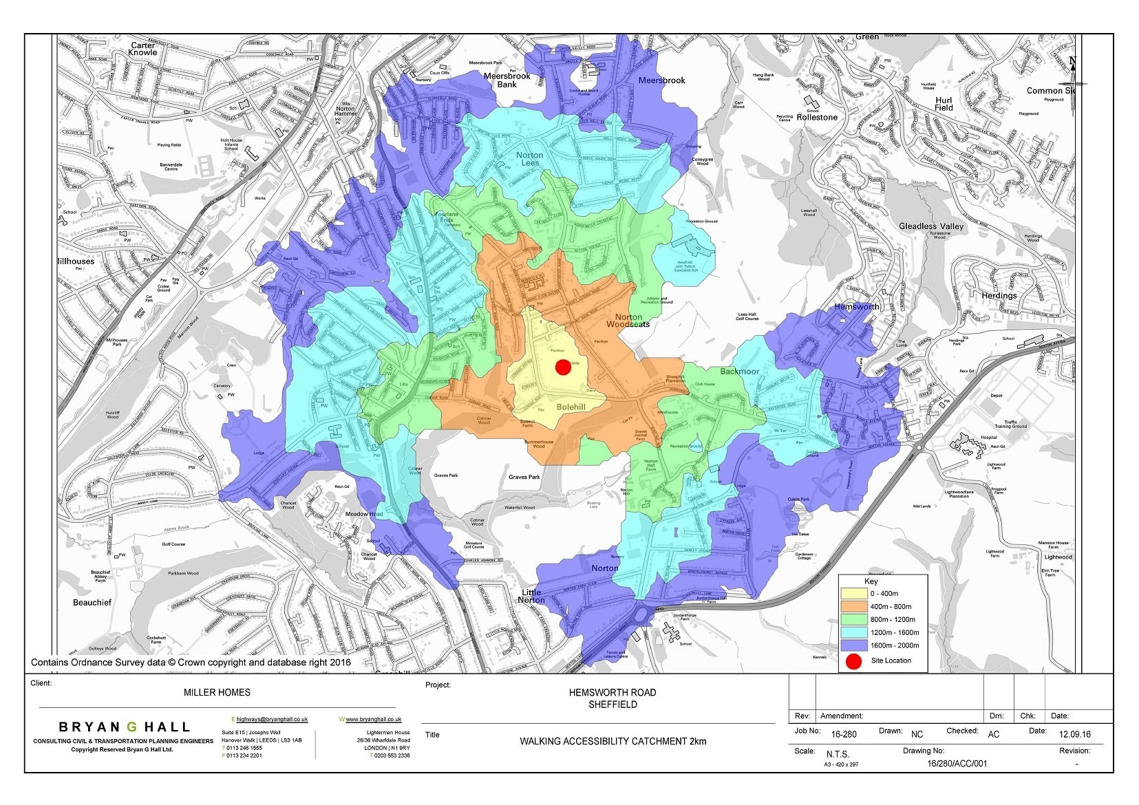
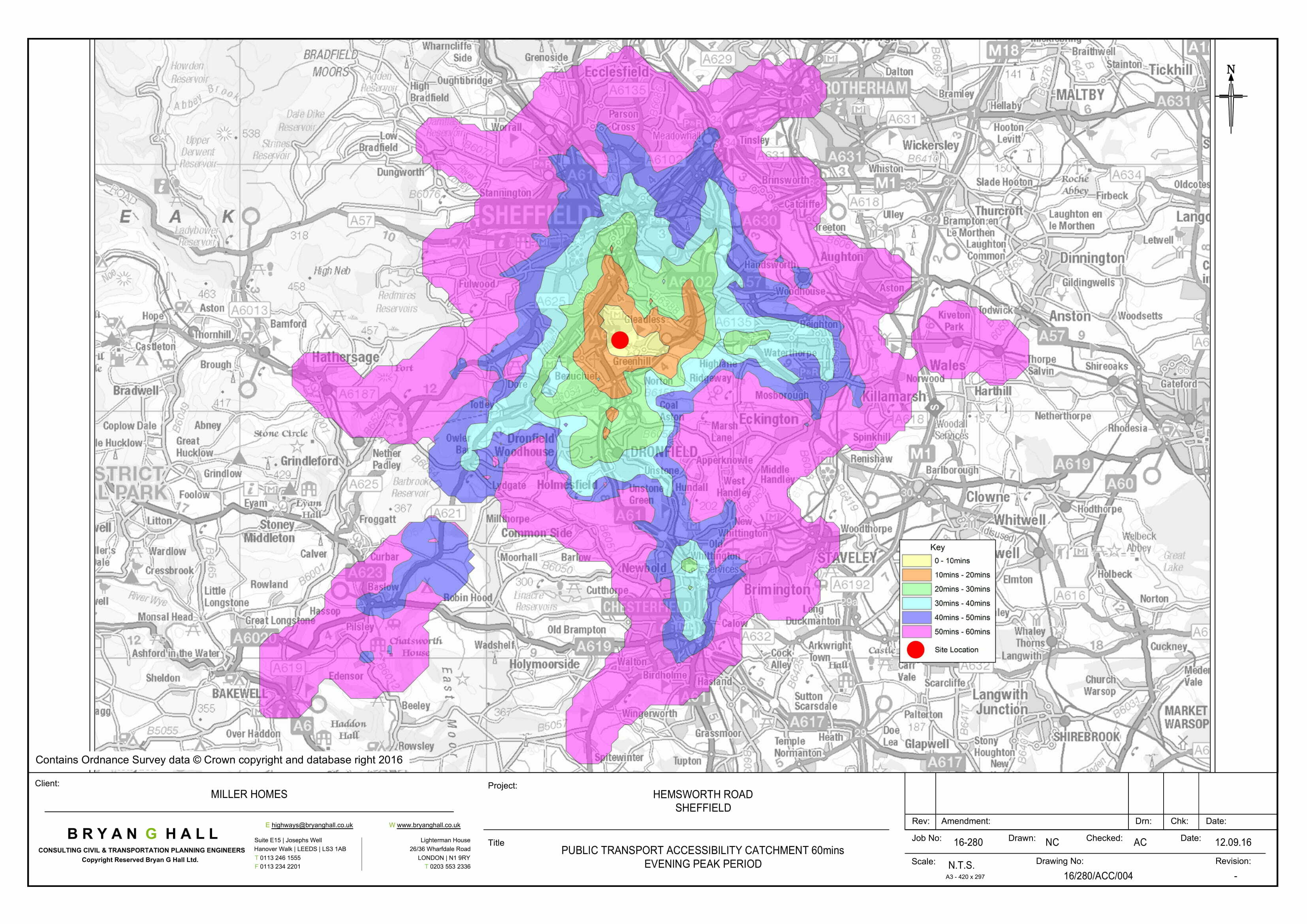
The planning team at the consultancy work on hundreds of projects a year using TRACC to show that proposed sites are accessible to key services by walking, cycling and public transport, as well as there being nearby bus links. Based on the new site/location, the team draw up plans to see what can be reached within appropriate catchments, then look for deficiencies. “If you are looking at a site on the outskirts of a town and looking at public transport accessibility, if it shows you can’t get into the city centre within an appropriate travel time, we would look at potentially improving or extending a service closer to the site,” said Nick Calder, Senior Engineer.
On a recent project looking at options for a new office site in London, Nick was able to load residential census data into TRACC to see that 50 thousand people were living within 2km of one possible location and therefore close enough to walk. When looking at public transport he could use TRACC to work out for example that 1.5 million people could access the site within a one hour travel time. These figures are incredibly useful to put into reports showing accessibility and allows Nick to score each site based on factors such as employment prospects.
What did TRACC deliver?
TRACC has also allowed the team to look at editing and extending existing road networks, testing ‘what if’ scenarios for sites. They have been able to look at the whole network of internal roads and realign existing roads that they were previously unable to do. They also use this facility to edit and extend public transport routes and see how much this improves a site's accessibility.
Before using TRACC the team used a straight line/circle approach, which was very simplistic and inaccurate. Now, using TRACC, travel time calculations can be done quickly, and the results are robust. Nick also highlights how TRACC has enabled them to have more time to take on additional work and give his clients a competitive edge, “the accessibility work we need to do is made much quicker by using TRACC which significantly increases our efficiency ”.